

اخبار العرب-كندا 24: الخميس 18 ديسمبر 2025 01:32 مساءً
A strong storm system is expected to bring a wet and windy warm-up to the Maritimes on Friday, with temperatures rising into the double digits and low teens.
To get temperatures that mild in mid-December, you need a really strong southerly wind and that’s exactly what’s on tap for the region.
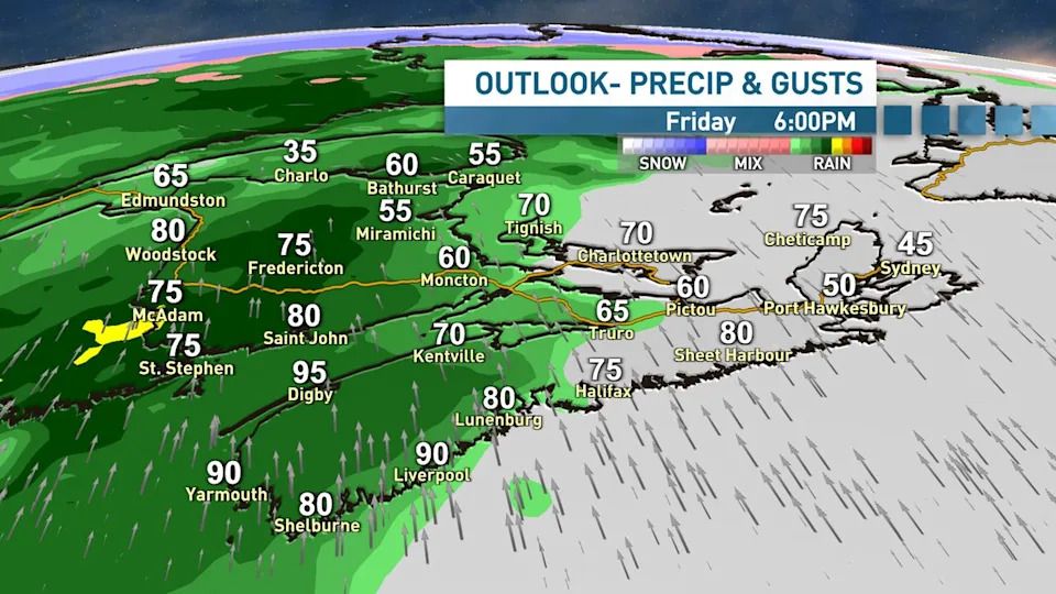
Widespread wind gusts of 80-100 km/h are on the way for Nova Scotia, Prince Edward Island and southern New Brunswick. Even stronger gusts are possible locally along exposed areas of the coast and also inland over higher terrain.
Rain and wind arrive from west to east on Friday afternoon and evening. (Ryan Snoddon/CBC)
Winds this strong typically cause some power outages so you should prepare for that possibility. Holiday decorations should also be well secured, unless you want your inflatable Santa and his reindeer to actually take flight!
Advertisement
Advertisement
Advertisement
Advertisement
The other part of the story will be the rain. A round of heavy rain will arrive with the winds on Friday with widespread totals ranging from 10-30 mm.
The rain, coupled with the warm temperatures and melting snow could cause run-off and the possibility of localized flooding, especially in areas with poor drainage.
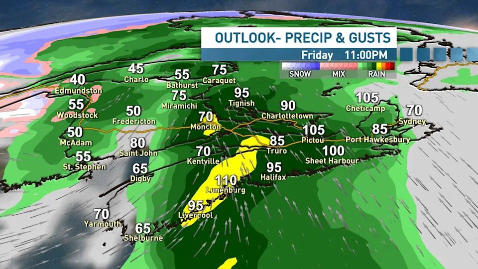
Peak wind gusts of 80-100 km/h are likely for most areas. Stronger gusts are possible along the coasts. (Ryan Snoddon/CBC)
A check of your local storm drains is recommended to make sure the water run-off has an exit route away from your home and property.
The heaviest rain and strongest winds will arrive in New Brunswick on Friday afternoon and continue into Friday evening. Nova Scotia will see the stormiest conditions beginning in the evening and continuing overnight.
(Ryan Snoddon/CBC)
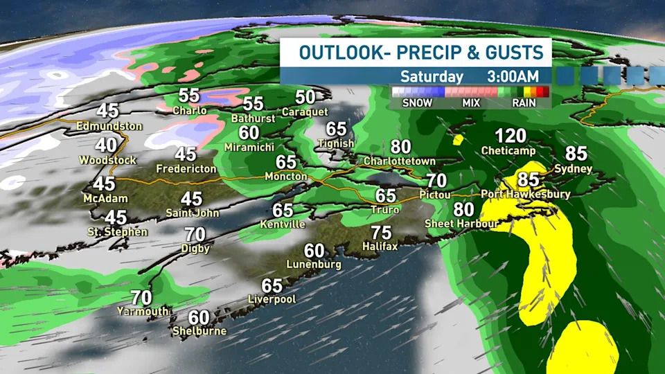
Behind the storm, temperatures are set to drop throughout the day on Saturday. With leftover standing water due to the rain and melted snow, we’ll see some icy conditions developing in the afternoon and evening on untreated surfaces.
Advertisement
Advertisement
Advertisement
Advertisement
Winds will remain strong on Saturday, with westerly gusts 60-80 km/h in the morning, easing throughout the afternoon and evening.
Next week
For those with travel plans, I’m watching a couple more systems which could cause some impacts or disruptions. The first will roll into the region on Sunday.
At the moment, it appears it will bring some snow to New Brunswick, with some mixing in the south.
It looks like mostly rain for Nova Scotia on Sunday, with the possibility of some mixing in the north and also on P.E.I.
After that, the next potential system showing up in the guidance is late Tuesday and into Wednesday, which is Christmas Eve.
There’s more uncertainty surrounding this one, but it appears some snow is possible for most. If you have travel plans, stay tuned to the forecast over the next few days.
MORE TOP STORIES
تم ادراج الخبر والعهده على المصدر، الرجاء الكتابة الينا لاي توضبح - برجاء اخبارنا بريديا عن خروقات لحقوق النشر للغير