

اخبار العرب-كندا 24: الثلاثاء 23 أبريل 2024 09:03 مساءً
Spring is a famously temperamental season and it’ll certainly live up to that reputation this week across Ontario.
DON’T MISS: Destructive wall of ice crushes cabins, damages properties
Temperatures will take a dive overnight Tuesday with readings that may again threaten the long-anticipated cherry blossoms with the chance of frost.
Conditions will gradually warm again by the end of the week, but will more reflective values of the season be here to stay? Or, can we anticipate a chance of more frost this spring?
Wednesday to Thursday: Chance of frost reappears
Cool days are ahead once more with daytime high temperatures just getting above the freezing mark in the northern sections and remaining in the single digits in the southern end.

Overnight temperatures will range from 1°C to as cold as -5°C in central Ontario on Thursday morning.
Frost is expected as a result, so, if you have begun planting already, it will be necessary to protect them beforehand.
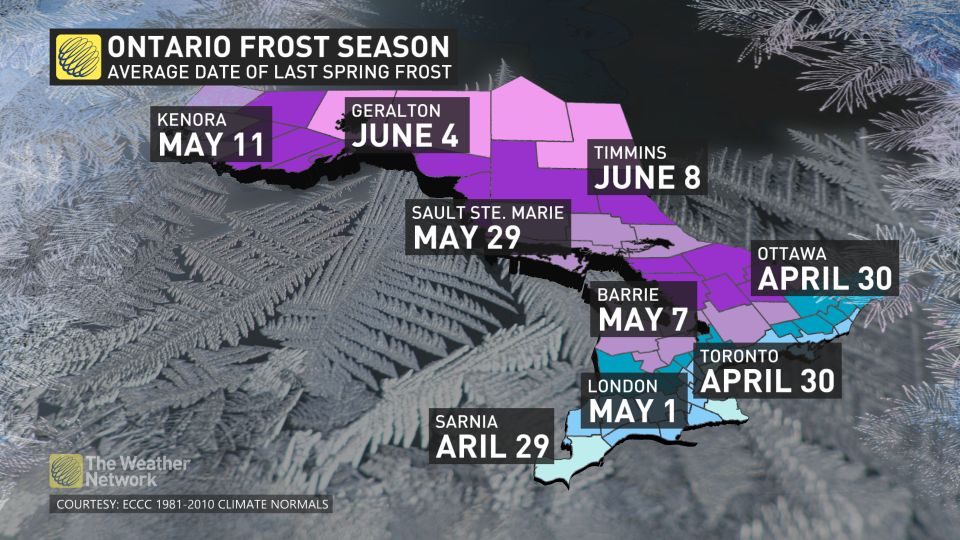
The average, last-frost date is around the end of April or the first week of May for southern Ontario. Those are just average dates, however, as below-freezing temperatures can occur to the end of May, but will that happen this year?
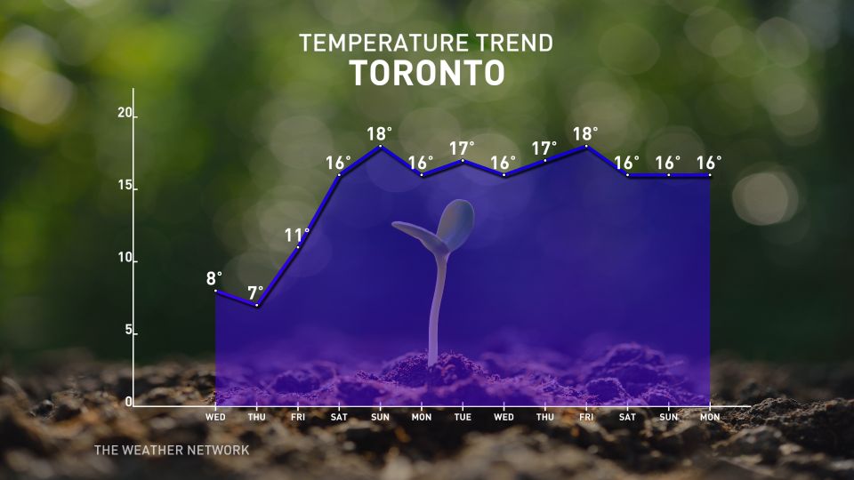
Saturday to next week: Temperature roller-coaster to wind down
Looking ahead, an additional round of unsettled weather is likely toward the end of the week and into this weekend. We’re stepping off the temperature roller-coaster, though, as this pattern will favour more consistently mild readings, along with a threat for potential thunderstorm activity in spots.
Consistent, mid- to high-teen temperatures will arrive from this weekend through all of next week.

As we head to the end of the month, the average temperatures are close to the low- to mid-teens. The forecast is to remain above seasonal for the rest of April and for the start of May.
Although this is good news as we head into the last month of spring, historically, half of Mays typically do reach below freezing temperatures.
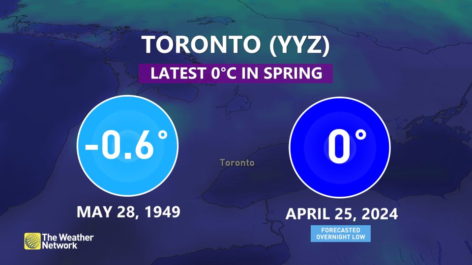
May 28, 1949 is the latest date that Pearson International Airport has seen a below 0°C temperature.

May 24, 1963 is the latest date that John C. Munro Hamilton International Airport has seen a below 0°C temperature, and June 9, 1980 is the latest date that Ottawa Macdonald–Cartier International Airport has seen a below °C temperature.
Stay with The Weather Network for the latest on your forecast across Ontario.
WATCH: Global conference meets in Ottawa this week to curb plastic pollution
Click here to view the video
تم ادراج الخبر والعهده على المصدر، الرجاء الكتابة الينا لاي توضبح - برجاء اخبارنا بريديا عن خروقات لحقوق النشر للغير


